Hiking Trails

The most popular trails of Armenian Highland are marked with informative 'poles' and maintained to assure safe hiking for local & incoming tourists. Most of the trails presented in this section pass through villages and cultural monuments; do not miss getting socialized with local communities. 

For your own safety, consult with local guides and plan your hike accordingly.

The trail starts from Aghavnadzor town (Vayots Dzork region) heading to Hors town (Vayots Dzor region), passing through green medows and forest-covered slopes of Karkatar mountains. You will come across with Aghavnadzor reservoir and Hors Lake (at 2100 meters) within the trail; you might set up your camp in the vicinity of the Lake. Plan a multiple day visit to Vayots Dzor and take an advantage of visiting dozens of destinations in the region. Do not miss tasting the mouth-watering Armenian wine in Areni.

The trail starts from the outskirts of Nor Amaghu village (Vayots Dzor region) heading to Noravank Monastery (Vayots Dzor region), passing through a moderate terrain surrounded with high cliffs and deep gorges. You will be passing parallel to Gnishik river during the last 30 minutes of the trail. By the way, the start point of this trail is around 15 minutes away from Areni, therefore you would better to plan a multiple day visit to Vayots Dzor and take an advantage of visiting dozens of destinations in the region. Do not miss tasting the mouth-watering Armenian wine in Areni.

Chabarak - Dzoravan Trail is located in Gegharkunik Province. Gegharkunik has a mountainous landscape. The territory is dominated by Geghama Mountains from the west, Vadenis Mountains from the south, Sevan Mountains from the east, Miapor Mountains from the northeast and the Kenats mountains from the north. The height of the mountains ranges between 2500 and 3500 meters. The climate of Gegharkunik is cold and snowy in winter, while the summer is characterized with warm and humid climate. You will definitely enjoy the fascinating views of Lake Sevan at some sections of the trail.

Vardahovit – Vernashen Trail is located in Vayots Dzor Province. The Province is home to several ancient landmarks and tourism attractions including the Areni-1 cave complex and Areni-1 winery of the Chalcolithic period, Tanahat Monastery (8th-century), Smbataberd fortress (10th-century), and Noravank monastery (13th-century). The village of Gladzor used to be the home to the 13th and 14th-century University of Gladzor. Do not forget to visit Jermuk – the spa-town, whenever you are in Vayots Dzor.

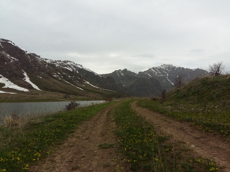
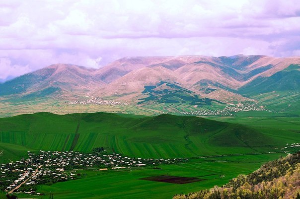
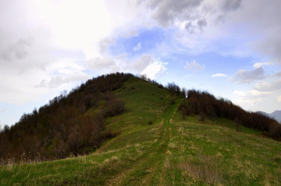
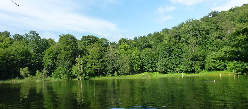
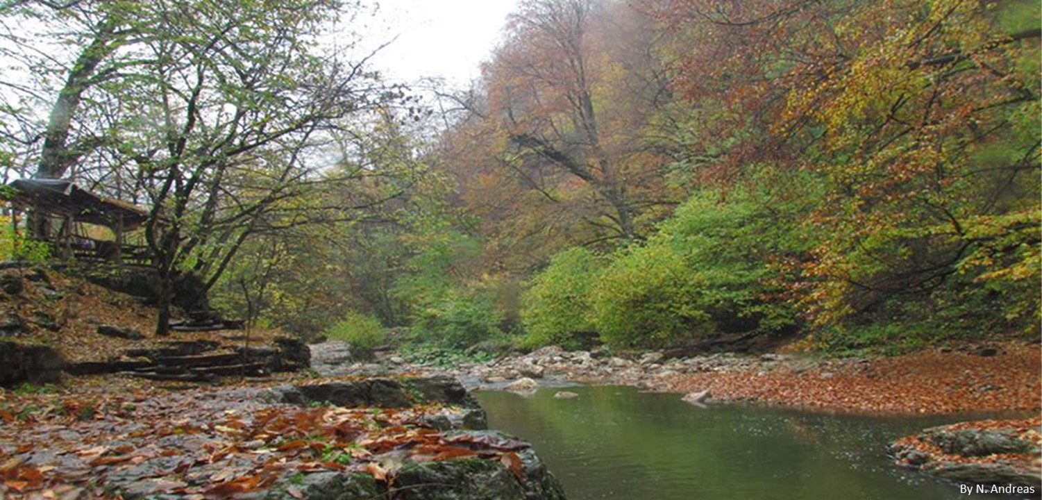
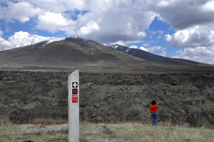
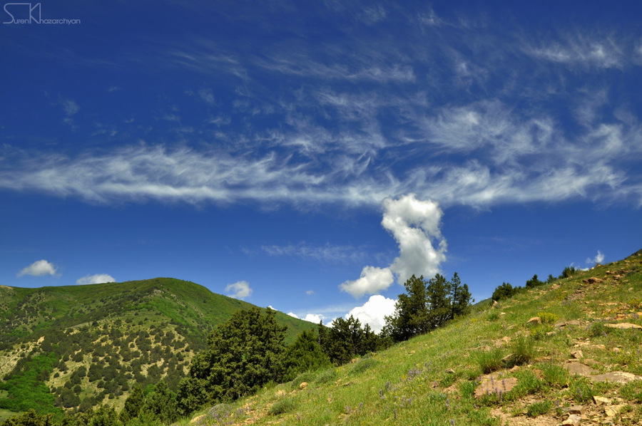
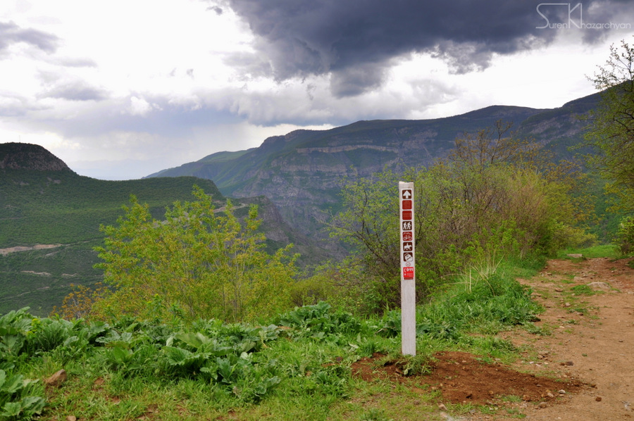
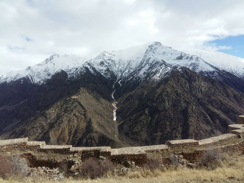
You will be impressed with amazing scenery, especially the mountain ranges all around Vayots Dzor. Beware of the diverse wild life specially birds; there are several sites for bird and animal watching along the Trail.

Overall trail data

Trail Length: 52.5km

Elevation: 2719m

Ascent: 3040m

Descent: 3547m

Difficulty: Intermediate

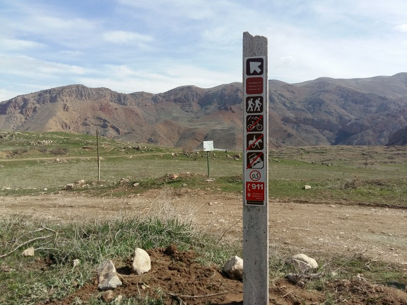
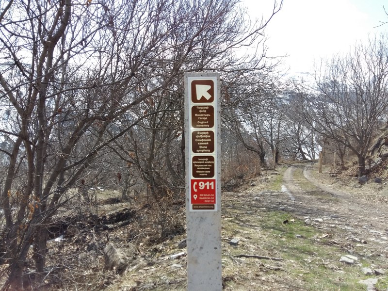
Rescue Service: 911, 112

Trail Functionality Symbols: Hike, Horse

Section 1: Vardahovit - Sevazhayr - Arates

Trail Length: 11.5km

Trail Duration: 5-6 Hours

Elevation: 2719m

Ascent: 783m

Descent: 874m

Difficulty: Intermediate

Trail Functionality Symbols: Hike, Horse

Section 2: Arates - Yeghegis

Trail Length: 14km

Trail Duration: 5-6 Hours

Elevation: 2418m

Ascent: 631m

Descent: 938m

Difficulty: Intermediate

Trail Functionality Symbols: Hike, Horse, Bike

Section 3: Yeghegis - Smbataberd - Artabuynq

Trail Length: 7km

Trail Duration: 5-6 Hours

Elevation: 1913m

Ascent: 395m

Descent: 488m

Difficulty: Intermediate

Trail Functionality Symbols: Hike, Horse

Section 4: Artabuynq - Shatin

Trail Length: 6.2km

Trail Duration: 2-3 Hours

Elevation: 1552m

Ascent: 115m

Descent: 396m

Difficulty: Intermediate

Trail Functionality Symbols: Hike, Horse, Bike

Section 5: Shatin - Shatinavank - Spitakavor - Vernashen

Trail Length: 13.4km

Trail Duration: 5-6 Hours

Elevation: 2148m

Ascent: 1123m

Descent: 849m

Difficulty: Intermediate

Trail Functionality Symbols: Hike, Horse

How to get there?

Considering the fact that you will start the trail somewhere and will finish it somewhere else, you will need a car-support to pick you up from 'end-points'.   

Where to stay?

Accommodation is relatively easy to arrange in vayots Dzor, both hotels and B&B's are very well managed. Do not forget to check in at Areni Wine Art in Areni Town, and Arevi Hotel in Yeghegis; you will be amazed with the hospitality and amazing views of Teqsar Mountain Range.
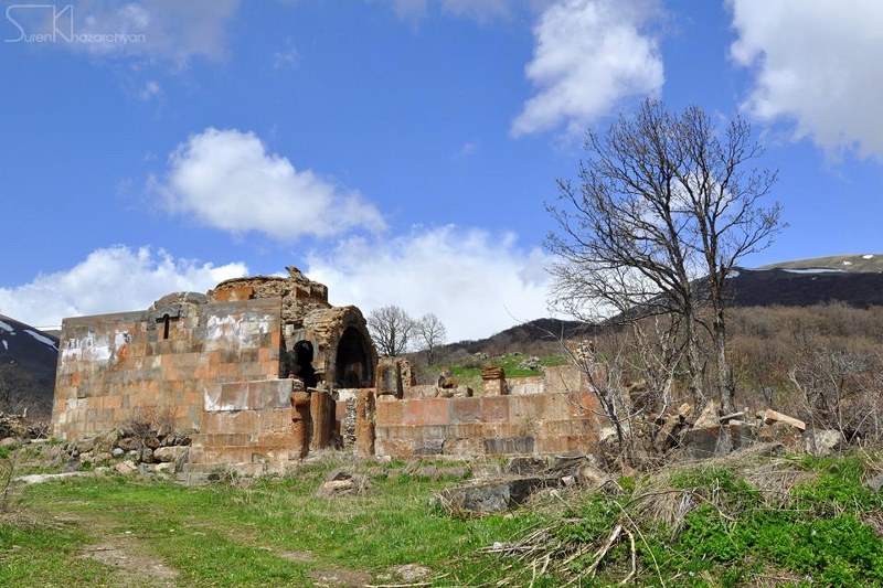
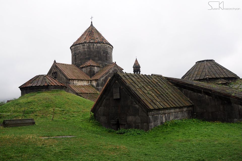
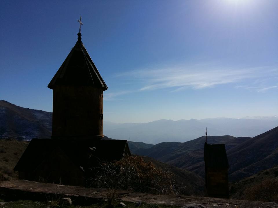
What to see around?

Arates Monastery

Yeghegis Monastery Complex

Smbataberd Fortress (V C.)

Spitakavor Monastery

Boloraberd (Proshaberd) Fortress (XIII c.)

Nearby destinations

Areni-1 cave complex

Areni-1 winery

Noravank Monastery

GPS track

To be published shortly

The trail starts from outskirts of Bjni town (Kotayk region) heading to Tsaghkadzor town (Kotayk Province), passing through green meadows and slopes covered by forests. The 3rd & last station of Tsaghkadzor ropeway (Ski resort) is located at the highest point of the trail. In the vicinity of the trail you will come across with several national & cultural monuments & attractions such as the Remains of Bjni Fortress (10-11th century) and Kecharis Monastery (13th century). Spectacular scenery is awaiting you especially during winter and spring.

The trail starts from Buzhakan village (Kotayk Province) heading to the 6-7th century Teghenyats Monastery while passing through green meadows and forest-covered slopes of Teghenis Mountain. The trail is moderate and suitable for family hikes.

The Complex includes the ruins of the ancient small transept St. Astvatsatsin church dated 6-7th centuries discovered during excavations, and also the ruins of Katoghike church dated 12th century, which is located about 30 meters from St. Astvatsatsin church.

You will find sources of drinking water on this trail;

The trail is appropriate for hiking, mountain biking and jeeping. In winter time, snowshoeing and ski touring is the best choice to get through this trail.

The trail starts from the 1st century Pagan Temple of Garni (Kotayk region) heading to Geghard Monastery (Kotayk region), passing through Azat River gorge - a smooth trail surrounded with high cliffs. You will be passing parallel to Azat River all way long the trail; you will be passing by Symphony of Stones - well preserved basalt columns, and the 11th century medieval bridge within the trail. Trails leading to Khosrov Forest State Reserve, and Havuts Tar Monastery are accessible from this trail. By the way, do not miss the mouth-watering fish BBQ in the Gorge.

Located on the South-west outskirts of Gosh village (2.2km), Gosh Lake with its marvelous scenery is one of the most interesting destinations for hiking, camping and even jeeping tours. The Lake is 100 meter long and 80 meters wide, with an average 2-3 meters depth (maximum: 8 meters) at 1450 meters above sea level.

Do not miss to visit the New Getik (Goshavank) Monastery Complex (12-13th AC), representing another amazing heritage of the Armenian Culture. The Complex was named after Mkhitar Gosh for his contribution in rebuilding of the Monastery.

Gosh Lake is also an interesting for those interested in fishing and crayfishing.

The trail starts from Haghpat Monastery Complex or Haghpatavank, dated 10th century (Lori Province), heading towards Sanahin Monastery Complex dated 10th century (Lori Province), and passing by Kayan Fortress dated 13th century and Akner village. Both Monastery Complexes are recognized by UNESCO as “World Heritage Sites” as they represent the flourished Armenian religious architecture, where the unique style was developed by a blend of elements from Byzantine ecclesiastical architecture and the traditional vernacular architecture.

The trail is moderate and appropriate for family hikes.

Lastiver is a 100-meters depth gorge covered with dense forest located in North-east of Armenia in outskirts of Yenokavan. There are several caves in the gorge with some petroglyphs; some not accessible easily.

You might start the trail from Apaga resort, will come across with the Yell Extreme Park to experience an extreme ziplining with a astonishing view of the surrounding. The trail passes by Khachaghbyur river and ends up by the Cascade waterfalls meters away from the Lastiver resort.

Visit and get refueled at Lastiver.

The trail starts from Hovhannavank Monastery located in Ohanavan village (Aragatsotn province), heading to Saghmosavank Monastery through Kasakh river gorge. You will be hiking through beautiful mountainous scenery with views of Mount Hatis (2,524 m) to the east, Ararat (5,165m) to the west, Ara (2,605 m) to the south, and Aragats (4,095m) to the north.  

You might come across with reptiles all during this trail, therefore, you will have to beware.

The trail is appropriate only for hiking. The best time to pass through this trail falls between April to November.

The trail starts from Solak village (Kotayk province), heading to Bjni town (Kotayk province). The trail is categorized as medium-difficulty and passes through green meadows & slopes.

Mayravank Monastery Complex is located on the trail, 3 kilometers out of Solak village. The Complex was founded in 7th century by Hovnan Mayravanetsi (Mayragometsi), while St. Astvatsatsin Church was built in 12th century.

The church is listed as a protected historic & cultural monument by Government of Armenia.

The trail is appropriate for hiking and snowshoeing in winter time.

The trail starts from Tatev Monastery Complex, dated 9th century (Syunik Province), heading towards Tatev Hermitage,  dated 17th century (Syunik Province), and Devil’s Bridge located beneath Tatev Monastery, in the 500-meter deep gorge of the Vorotan River.

In October 2010, Wings of Tatev, the longest aerial tramway in the World was opened, to replenish the heritage with modern infrastructure which was later recorded in the Guinness Book of Records as the World’s longest reversible cable-way.

The trail is moderate and appropriate for hiking.

The trail starts from Vernashen village in Vayots-Dzor province, it leads to Spitakavor Monastery (14th c.) and Proshaberd (Boloraberd) Fortress (13th c.). The terrain is moderate and passes through forests for about 7 km to get to the Monastery, thereafter for about 2 km through steep slopes up to the ruins of Proshaberd Fortress. Several kilometers from the Fortress, you will come across with ruins of an old town.

Even-though you can take the same trail back to Vernashen but it is highly recommended to go around Proshaberd where you will find the steep slopes and high cliffs surrounding the Fortress, making it inaccessible for invaders.

Water streams will be found all around the trail. Beware of bears especially in early morning and late-night hikes.

The trail starts from Yeghegis Town in Vayots-Dzor province, it leads to Smbataberd Fortress (5th century) and TsakhatsKar Monastery (10th century). The terrain is moderate and assures amazing views of Teksar Mountains. Zorats Church of Yeghegis (14th century) is right in the beginning of the trail. 

The trail is moderate and appropriate for hiking, however, beware of bears especially in early morning and late-night hikes.

Leave No Trace

  • Plan ahead & be prepared
  • Dispose the waste properly
  • Leave what you find
  • Minimize campfire impacts
  • Respect the wildlife
  • Be considerate of other visitors

Roads conditions

It is winter time! Check out road conditions before heading to the road! Beware of the snow & ice layer!

Vanadzor - Alaverdi section of the M6 Interstate highway stretching from Yerevan to Georgian border is temporarily closed. You can use Vanadzor-Stepanavan-Odzun-Alaverdi bypassing road.

© 2021. Powered by Adventures.am